 ISURVEYOR
 【 SURVEY 】 Topographic Survey
10
03 -
20
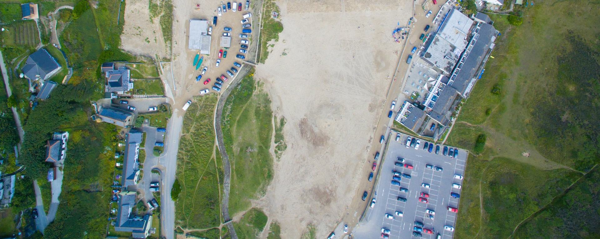 Topographical helps determine accurately the terrestrial or three-dimensional space position of points and the distances and angles between them using leveling instruments such as theodolites, dumpy levels and clinometers.Topographic surveying is a field of geoscience and planetary science and is concerned with local detail in general, including not only relief but also natural and artificial features, and even local history and culture.Topographic surveying is the mapping of existing natura...
【 3D 】 What is BIM
10
03 -
20
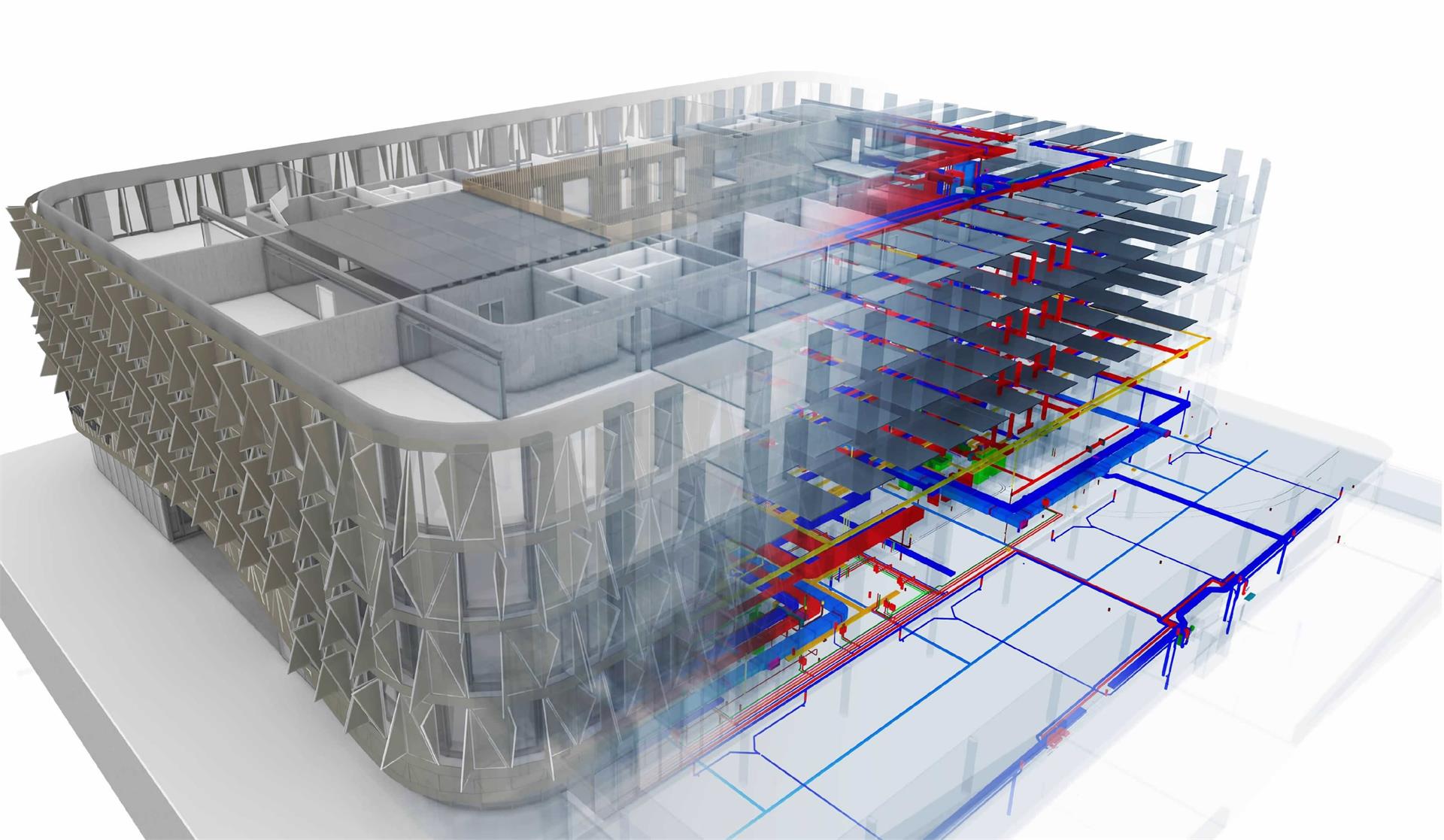 Building information modeling (BIM) is a process supported by various tools, technologies and contracts involving the generation and management of digital representations of physical and functional characteristics of places.Building information models (BIMs) are files (often but not always in proprietary formats and containing proprietary data) which can be extracted, exchanged or networked to support decision-making regarding a built asset.Learn more on https://en.wikipedia.org/wiki/Building...
【 GIS 】 What is GIS
10
03 -
20
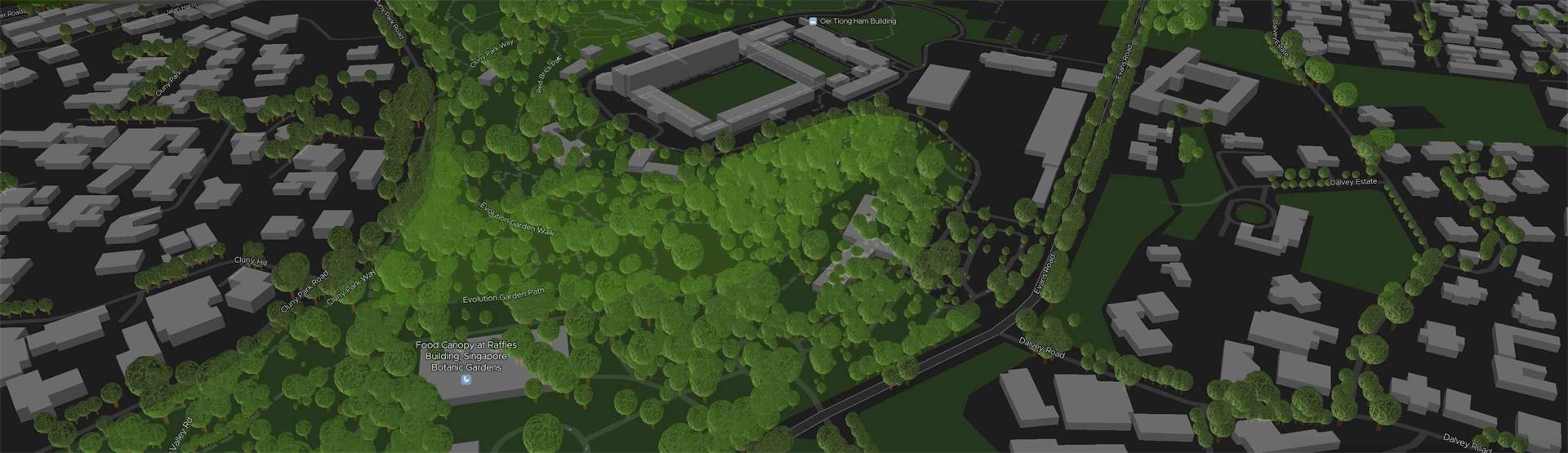 A Geographic Information System (GIS) is a system designed to capture, store, manipulate, analyze, manage, and present spatial or geographic data. GIS applications are tools that allow users to create interactive queries (user-created searches), analyze spatial information, edit data in maps, and present the results of all these operations. GIS (more commonly GIScience) sometimes refers to geographic information science (GIScience), the science underlying geographic concepts, applications, an...
【 3D 】 3D Reality Capture
09
03 -
20
 3D Reality Capture is a process of scanning and capturing any site, for example plants, buildings or crime scenes, in a 3D digital model, combining measurements and imagery. The resulting model can be used for design and comparison purposes, to ensure site safety in inhospitable environments or as evidence in a criminal case, capturing every detail with to-the-millimetre accuracy.