 ISURVEYOR
 【 SURVEY 】 >> What is Survey
09
03 -
20
 Surveying or land surveying is the technique, profession, art and science of determining the terrestrial or three-dimensional positions of points and the distances and angles between them. A land surveying professional is called a land surveyor. These points are usually on the surface of the Earth, and they are often used to establish maps and boundaries for ownership, locations, such as building corners or the surface location of subsurface features, or other purposes required by government ...
【 GIS,NEWS 】 Explore NPark's Tree GIS Portal
14
03 -
20
 National Parks Board (NParks) Tree GIS Portalhttps://www.nparks.gov.sg/treesExploreTrees.SGhttps://exploretrees.sg/
【 SURVEY 】 Dimensional Control Survey
12
03 -
20
 This is a type of survey conducted in or on a non-level surface. Common in the oil and gas industry to replace old or damaged pipes on a like-for-like basis, the advantage of dimensional control survey is that the instrument used to conduct the survey does not need to be level. This is useful in the off-shore industry, as not all platforms are fixed and are thus subject to movement.Read more on https://en.wikipedia.org/wiki/Surveying
【 SURVEY 】 Hydrographical Survey
11
03 -
20
 Hydrographical survey involves the measurement and description of features of the seabed / riverbed, swamps, ponds, dredging site, foreshore structure and the 2.515 HWM line. Registered Surveyor carries out such survey at coastal areas whereas hydrographic surveyor conducts their survey in deep seas for maritime and navigational purposes.Hydrographic survey is the science of measurement and description of features which affect maritime navigation, marine construction, dredging, offshore oil ...
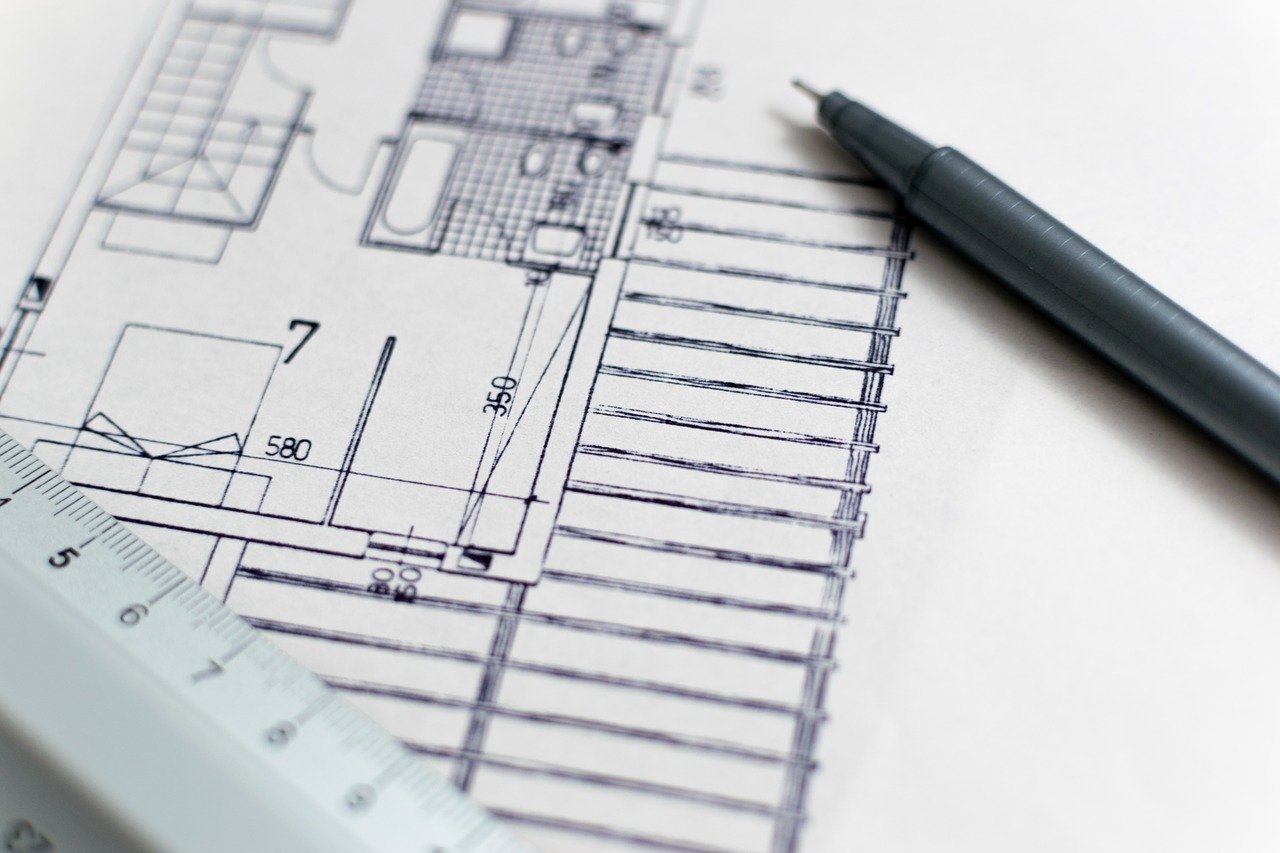
【 SURVEY 】 Measured Survey
11
03 -
20
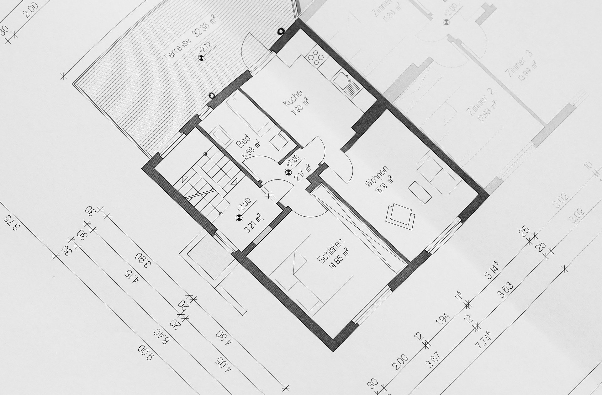 To survey buildings under conservation, their facades using 3D scanning technology or the conventional 3D point survey and to produce elevations, cross sections and floor layouts of the buildings, such a survey may be conducted before renovation works, for commercial purpose, or at end of the construction process.
【 SURVEY 】 Monitoring Survey
11
03 -
20
 Deformation monitoring is to measure the position of structures or their surrounding features at regular time interval for position changes. This data is useful for the purpose of deformation analysis, predictive maintenance and triggering of alarming system. Temporary stop-work or corrective works can be applied in time to prevent serious incidents from happening.Deformation monitoring (also referred to as deformation survey) is the systematic measurement and tracking of the alteration in t...
【 SURVEY 】 Tunnel Survey
11
03 -
20
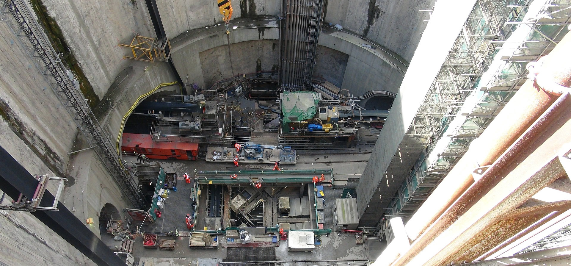 Tunnel survey involves in measuring the locations and layout of tunnel’s position and guiding of tunnel boring machine in the correct direction and position. Survey activities include ground surface survey, transferring the alignment and levels underground, measuring tunnel position and providing boring line.
【 SURVEY,GIS 】 Road Data Hub/GIS Data Hub
11
03 -
20
 Road Data Hub/Road GIS Data HubThis survey involves the recording of existing physical information along the road for inventory purpose. The survey measures road infrastructures consisting of road tarmac, link ways, dividers, bridges, drains, bus bays, railings, manholes, traffic junctions, signs & terminals, parking space, trees, and encroachment issues.
【 SURVEY 】 As-built Survey
11
03 -
20
 As-built survey is usually required after the construction is completed for purpose of comparing it with the design drawings. As-built survey plan is submitted to relevant authorities. As-built survey documents the location of recently constructed elements of a construction project. As-built surveys are done for record, completion evaluation and payment purposes. An as-built survey is also known as a 'works as executed survey'. As built surveys are often presented in red or redline and laid o...
【 SURVEY 】 Engineering Survey
11
03 -
20
 Engineering survey is a service usually rendered to construction companies for the construction of buildings, roads, tunnels, drainage & sewerage lines, parks, land reclamation, airports and wharves.Engineering surveying: topographic, layout, and as-built surveys associated with engineering design, Often need geodetic computations beyond normal civil engineering practice.
【 SURVEY 】 Cadastral Survey
11
03 -
20
 Cadastral survey (or previously known as title survey) refers to survey of land and strata lots for the purposes of registration of land-ownership, issues of land titles and other land-related matters. It involves the demarcation of property boundaries and determination of areas and is regulated under the provisions of the Boundaries & Survey Maps Act. One of the primary roles of the land surveyor is to determine the boundary of real property on the ground. That boundary has already been est...