 ISURVEYOR
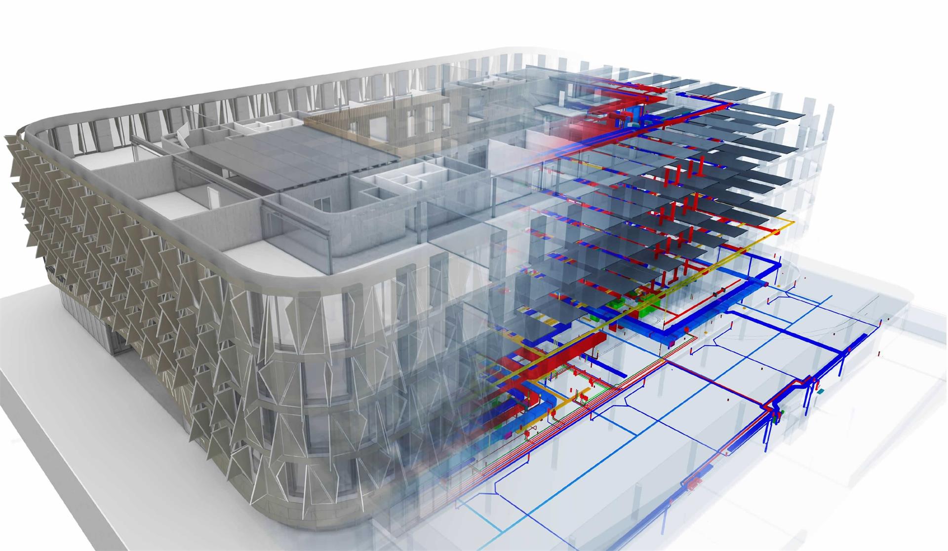
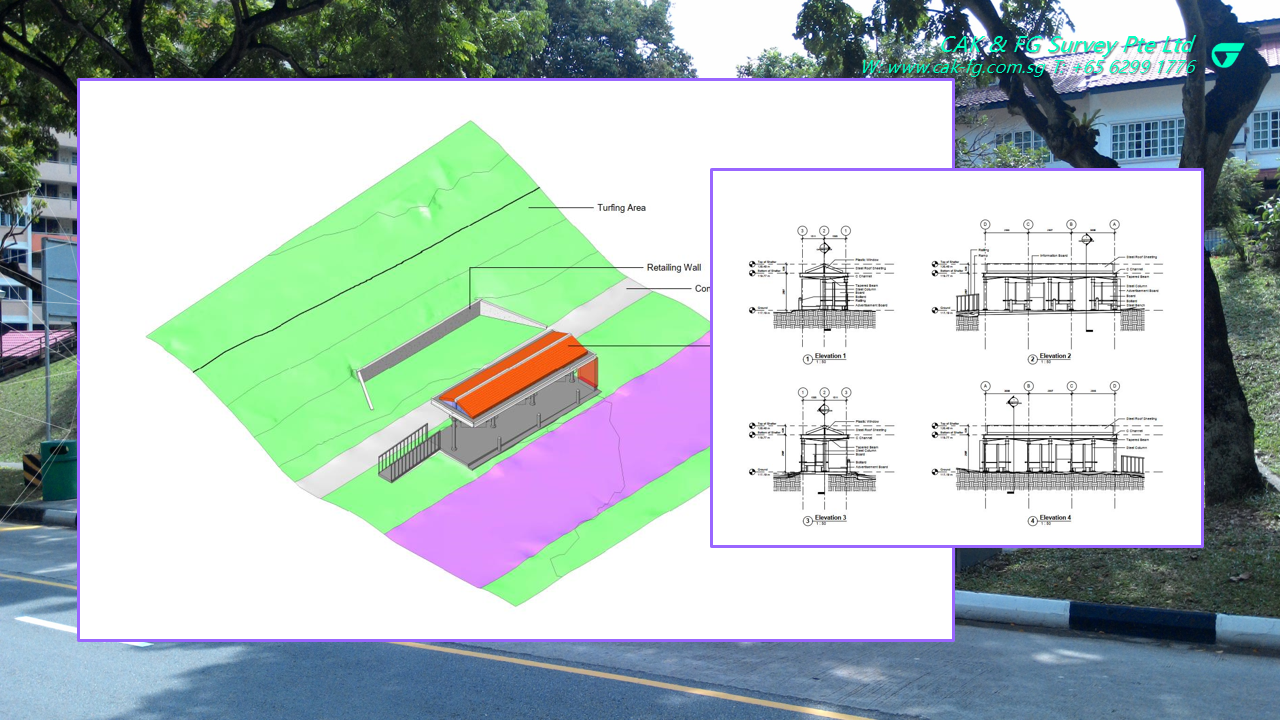
Building information modeling (BIM) is a process supported by various tools, technologies and contracts involving the generation and management of digital representations of physical and functional characteristics of places.
Building information models (BIMs) are files (often but not always in proprietary formats and containing proprietary data) which can be extracted, exchanged or networked to support decision-making regarding a built asset.
Learn more on https://en.wikipedia.org/wiki/Building_information_modeling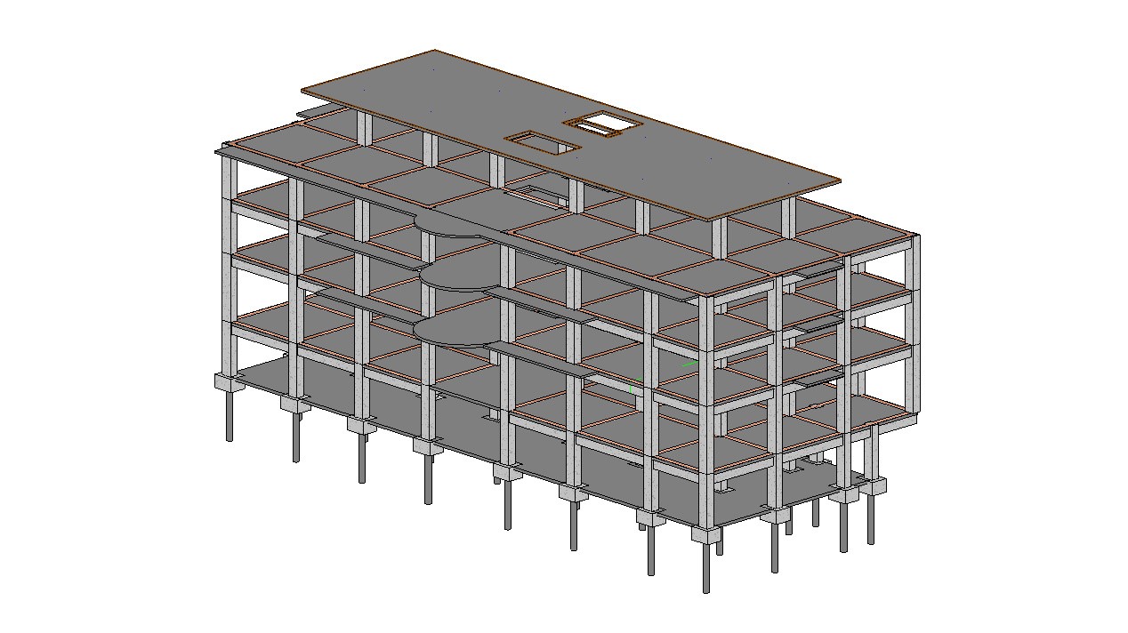
BIM is a highly collaborative process that allows multiple stakeholders and AEC (architecture, engineering, construction) professionals to collaborate on the planning, design, and construction of a building within one 3D model. It can also span into the operation and management of buildings using data that owners have access to. This data allows owners and stakeholders to make decisions based on pertinent information derived from the model— even after the building is constructed.
Learn more on https://constructible.trimble.com/construction-industry/what-is-bim-building-information-modeling
IFC is a standardized, digital description of the built asset industry. It is an open, international standard (ISO 16739-1:2018) and promotes vendor-neutral, or agnostic, and usable capabilities across a wide range of hardware devices, software platforms, and interfaces for many different use cases.
Today, IFC is typically used to exchange information from one party to another for a specific business transaction. For example, an architect may provide an owner with a model of a new facility design, an owner may send that building model to a contractor to request a bid, and a contractor may provide the owner an as-built model with details describing installed equipment and manufacturer information. IFC can also be used as a means of archiving project information, whether incrementally during the design, procurement, and construction phases, or as an "as-built" collection of information for long-term preservation and operations purposes.
Learn more on https://technical.buildingsmart.org/standards/ifc
CONTINUE READING
- Explore NPark's Tree GIS Portal
- Dimensional Control Survey
- Hydrographical Survey
- Measured Survey
- Monitoring Survey
- Tunnel Survey
- Road Data Hub/GIS Data Hub
- As-built Survey
MORE READING
- PREV: What is GIS
- NEXT: Topographic Survey